Safe by Design
As part of New York City’s Vision Zero commitment to eliminating preventable traffic deaths and injuries, the city is redesigning many of its streets to make them safer. Using roadway geometry like lane width and type, intersection design, and elements such as curb extensions, raised medians, and roundabouts, DOT aims to encourage safe driving, reduce crossing distances for pedestrians, and create dedicated space for cyclists. A redesigned street can both lessen the likelihood of a crash and reduce the severity of crashes that do occur. An expanded program of Street Improvement Projects drawing upon the tools outlined in this section of the Manual contributed to five consecutive years of declines in road deaths following the establishment of Vision Zero as citywide policy. DOT will continue to implement these design elements to further decrease fatalities and serious injuries on New York City streets.
Streets should be designed to protect the most vulnerable users, particularly pedestrians and cyclists, while maintaining necessary vehicular access. The two goals are not mutually exclusive. In fact, improvements made explicitly to enhance safety can also simplify the flow of traffic and eliminate confusion among roadway users. DOT’s commitment to safety is paramount, and while street design improvements may require changes in parking allocations or vehicular access, DOT strives to minimize disruption and encourages community feedback on projects.
Vehicle Target Speed
Streets should be designed with target speeds and speed limits appropriate to their surrounding uses and desired role in the vehicular network. The citywide speed limit is 25 mph, except where otherwise noted. New York State Vehicle & Traffic Law (VTL) Section 1642(a)(26) and (27) currently allow speed limits below 25 mph, and as low as 15 mph in New York City if used in conjunction with traffic calming measures. Slower target speeds and speed limits should be considered on local streets and residential streets; on streets adjacent to schools; in areas with higher populations of older adults or people with disabilities; and on waterfronts, in parks, or in and around other significant pedestrian destinations.
As part of its efforts to enhance safety, DOT deploys traffic calming devices in neighborhoods around schools and in areas with high numbers of crashes involving older adults. Some traffic calming treatments, such as raised medians, can also enhance the public realm by expanding pedestrian space and incorporating greenery. Community groups can also request certain traffic calming interventions, such as raised medians and corner bulbouts, at specific locations by contacting their DOT Borough Commissioner.
Roadway Width, Corner Radii, and Crossing Distance
The roadway — the portion of a street ordinarily used by motor vehicles and cyclists, exclusive of the sidewalk — should be designed to be the minimum possible width, with the minimum number of lanes, that safely and cost-effectively allows for the travel of motor vehicles and cyclists. Narrower roadways minimize pedestrian crossing distances, encourage safe driving behavior, and reduce impermeable, heat-absorbing asphalt coverage.
Roadway modifications should be designed for the expected traffic volumes in the year that construction will be complete.. Additional consideration should be given to recent trends in traffic and mode choice — as documented in DOT’s Mobility Report— and their implication for traffic volumes in future years (e.g., five years after the build year). Excess width should be reallocated to provide walking, transit, and bicycling facilities, public open space, green cover, and/or stormwater source control measures. If financial limitations preclude capital implementation of street redesigns (e.g., curbing or streetscaping), the reallocation of space should still proceed with less costly operational approaches such as restriping.
To reduce pedestrian crossing distances further and slow turning vehicles, all roadway corners should be designed with the smallest possible radius that still accommodates the design vehicle and emergency vehicles.
Pedestrian crossing distances should be minimized in all locations utilizing treatments such as curb extensions (i.e., neckdowns) with detectable warnings to make edge conditions clear to pedestrians with vision disabilities. Sidewalk narrowings and roadway widenings should be avoided.
Design Vehicles and Emergency Access
The design vehicle used for geometric street designs, typically a single-unit truck, with a 30-foot long wheelbase (SU-30), should be appropriate to the predominant intended uses of the given street and should not include commercial vehicles larger than New York City’s maximum allowable length. In addition, all street designs must consider FDNY, other emergency vehicle, and sanitation vehicle access needs (e.g., for street sweeping and snow clearing). Larger design vehicles, such as tractor-trailer trucks with wheelbases varying from 40 feet (WB-40) to 62 feet (WB-62) in length, are used on bus and designated truck routes depending on the route type, context, and special route provisions.
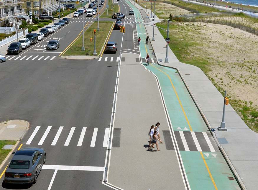
Shore Front Parkway, Queens
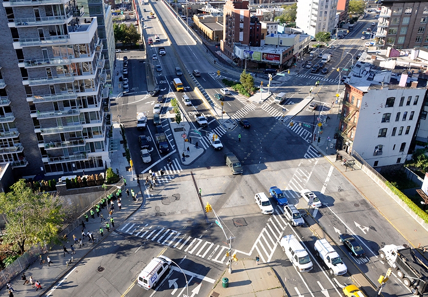
Complex Intersections
Multi-leg or skewed angle intersections should be redesigned (to the extent practicable) to simplify operations and reduce or separate conflicts. This can include the removal of intersection legs and slip lanes that are inconsequential to the traffic network, creation of right-angled intersection alignments, and simplified traffic patterns. Resulting space should be consolidated to create new public open space and shorter, more direct crossings.
The use of slip lanes should generally be avoided except where conflicts are mitigated and overall safety is significantly improved by their use. If one is necessary, it should produce a conflict-free crosswalk from the island.
Maintenance
Unless a maintenance partner can be identified, new geometric treatments, including curb and sidewalk extensions in operational materials, must leave a minimum of 11 feet of roadway width to accommodate standard street sweepers and snow plow operations.
Inclusive Design
Projects should be designed to make it easier for New Yorkers with disabilities, older adults, and children to navigate the city. To this end, designs should consider how people with diverse ability levels will use and move through the space.
Pedestrian spaces should have clearly defined pathways with minimal clutter that are easy to understand, regardless of users’ ability level or experience. Delineation treatments should be developed in conjunction with stakeholders to meet the mobility needs of the intended users. Designs should incorporate multiple ways of communicating effectively with users. Examples include pedestrian ramps and detectable edge treatments. Projects must meet or exceed all applicable federal, state, and/or local accessibility standards for facilities and public rights-of-way, including minimum clear-path widths, inclusion of ADA-compliant ramps, and provision of accessible transit facilities.
Drainage and Stormwater Control
All modifications to street geometry should avoid unintended changes in the direction and disposition of stormwater runoff so as not to create ponding or flooding issues. Adequate roadway grades (i.e., 1.5% desired, with a minimum of 0.5%) are required to direct runoff to catch basins. Include planted areas and stormwater source controls within the roadway wherever feasible. For more information on green infrastructure treatments, see Stormwater Management Practices. Stormwater control within the street network may offer opportunities for resiliency benefits in areas that experience frequent flooding.
Resiliency
Resilient design enhances a street’s ability to return to service quickly and without excessive cost or inconvenience to the public following a climate-related event, like flooding or extreme heat. At the network level, resiliency helps maintain access to critical facilities, such as hospitals and storm shelters, during flood events.
Climate-related risks and their triggers and thresholds should be evaluated during the design process. Mitigation strategies include, but are not limited to, raising streets, creating landscaped berms, and installing permanent or deployable flood walls. Designs should seek to minimize damage to DOT assets while allowing traffic circulation for all vehicle types. Projects in the current and future 100-year floodplain should consult the latest version of MOR’s Climate Resiliency Design Guidelines.
Sustainability
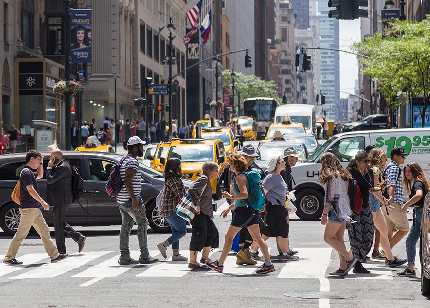
In 2017, New York City recommitted to the Paris Climate Agreement through Executive Order 26. Releasing the 1.5 Climate Action Plan, the city committed to more aggressive near-term climate change mitigation goals, building upon the existing sustainability efforts in the Roadmap to 80x50 and the DOT Strategic Plan. A core goal in the city’s climate change mitigation strategy is growing the share of trips made using sustainable modes—transit, walking, and biking—from 66% to 80% by 2050. Prioritizing these modes in order to enhance safety and inclusivity also creates a more sustainable transportation system.